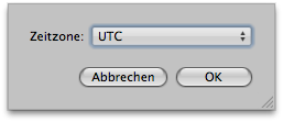
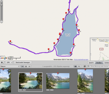
Having returned from our trip to South Tyrol, I grabbed my GPS tracks off my Columbus V900, piped them through GPS Babel and loaded them into Aperture. After placing the first photo on the track to set the time offset, I was shocked. All images were misplaced, some images did not receive GPS coordinates at all… something very strange was going on. After a odyssey through the Internet (where I stumbled across BT747, a nice program to convert track formats), countless conversions from one format to another (via a third format), which all lead to the same crappy result, I found out what was the problem: the time zone which Aperture quietly assumes the track files have. One click here:
 …and (amlost) everything was ok – if you place the cursor over a different zone before clicking „ok“, Aperture will also notice that it should apply the changes. Very buggy behavior indeed – and since last time the GPS placement worked fine (which was before daylight savings time), there’s a major bug on the loose here. Here’s the workflow I had to use:
- convert Columbus-CSV-files to GPX (use whatever you like most here, BT747, GPS Babel or anything else but TimeAlbum which causes Aperture to crash repeatably)
- Read track into Aperture
- Set track time zone to UTC
- Place first photo (Caution: use the correct offset to UTC here – in my case, that was MESZ-UTC= -60 min.)
- Let Aperture place the rest of the photos along your track.
